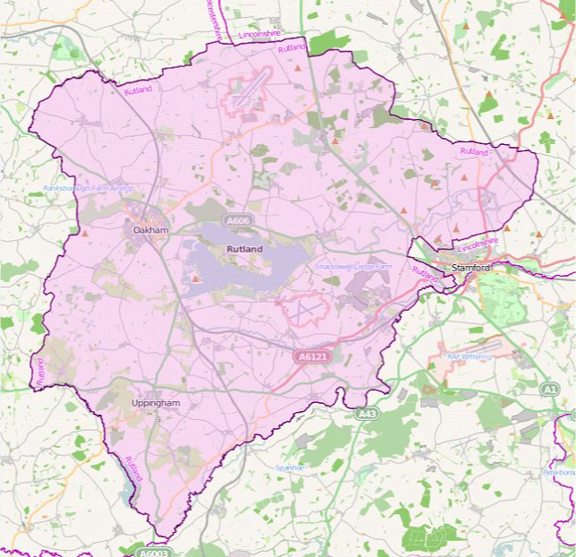

Rutland County
(Historic)
Map Reference: (52.673648, -0.648261)
Rutland is an inland county, the smallest in England. Rutland's length north to south is 18 miles at its longest, and its breadth east to west 17 miles. The highest point of the county is at Flitteriss Park (a farm east of Cold Overton Park) at 646 feet. Rutland is almost entirely agricultural. The shire is marked by numerous pretty villages characterised by cottages of limestone and ironstone, with roofs thatched or of Collyweston stone slate. The county town of Oakham, in the Vale of Catmose, is a small, charming market town centred around a small square and market-cross. Oakham Castle is a fortified manor house with a 12th-century Great Hall. Uppingham is a small market town, home of the public school, Uppingham School. Rutland Water is a large reservoir formed in the 1970s by damning the Gwash, now a wetland of international importance.