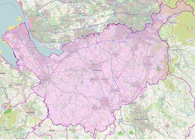

Cheshire County
(Historic)
Map Reference: (53.183263, -2.586008)
The County Palatine of Chester is a maritime county. Much of Cheshire lies in the great lowland expanse of the Cheshire Plain. The Plain extends up to Cheshire's northern border (the Mersey) and beyond Cheshire's southern border, into Shropshire. Westwards, the Plain extends beyond Cheshire to the Welsh hills, and eastwards to the Peak District. In the county's north-west is the Wirral peninsula, separating the Dee and the Mersey, the peninsula including the ancient port of Birkenhead. The ancient City of Chester, founded in AD79, stands on the River Dee close to the Flintshire border. Along Cheshire's border with Lancashire, the rivers Mersey and Tame, are many industrial and suburban towns, including Altrincham, Sale, Stockport, Hyde and Stalybridge. The central part of the county has been a salt-mining area since Roman times, especially around Nantwich, Northwich and Middlewich. The rest of the county is largely rural but with many historic towns, including Knutsford, Wilmslow, Alderley Edge, Macclesfield, Congleton and Crewe.